


LOCOPAS app for iPhone and iPad
Developer: Kyoto Entertainment Works Inc.
First release : 30 Jul 2017
App size: 34.63 Mb
LOcation × COmment × Photo for Area Studies
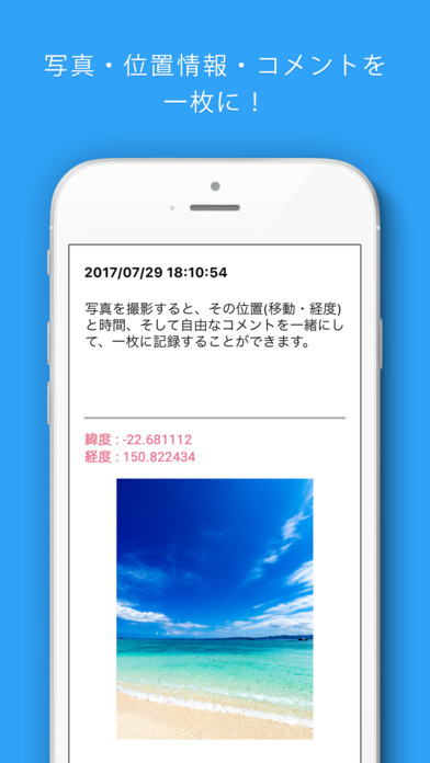
When you take a picture, you can save the location (latitude and longitude), time, and your message altogether by recording them on one screen.
Preserve your memories along with the details of “when, where, and what.”
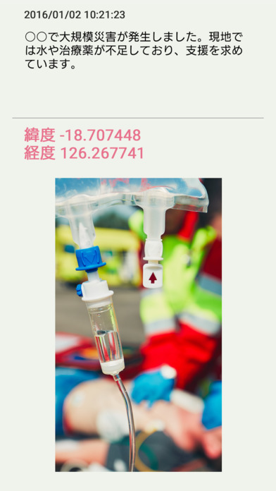
During disasters and emergencies, you can easily specify “when, where, and why” you require assistance, sending the message across a wide area through SNS.
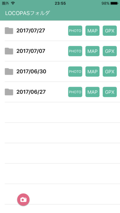
The app uses GPS, mobile networks, etc. to record your location. A GPX format of the geographic information intended for GPS and GIS research specialists is also available for output.
This app was jointly developed by the following institutions to record and research “when, where, and what” occurred academically:
- The Graduate School of Asian and African Area Studies of Kyoto University
- The Disaster Prevention Research Institute of Kyoto University
- The Kyoto University Unit of Synergetic Studies for Space
- Kyoto Entertainment Works Inc., an app production company
Developed by: Takuro Furusawa (leader), Takashi Sugishima, Akihisa Iwata, Mitsunori Hatayama, and Ryuta Himoto at Kyoto University; Kazutaka Ueno, Daisuke Sugiyama, and Ryota Sonogi at Kyoto Entertainment Works Inc.
This app was developed as part of the study, “Strengthening the Disaster Resilience of Local Communities through Interactive Real-Time Area Studies using SNS and Cloud GIS Methodologies” (PI: Takuro Furusawa) under the “Topic-Setting Program to Advance Cutting-Edge Humanities and Social Sciences Research” (‘Area Cultivation’ Program) of the Japan Society for the Promotion of Science.